Sierra

Sierra
Sierra

Tuesday, April 3, 2012

3/30/12-04/02/12 Desert Escape

It has been 2 years (Zion in April 2010) since Allison and I have been able to get out of town for some time to ourselves.  With some time off and grandparents willing to watch our 18 month old daughters for 3 nights, it was a no brainer to embark on one of our favorite Spring trips (like just about everybody who is into the outdoors in the Front Range), go to the Utah desert and soak up some warmth and sunshine.  Originally, we were planning to meet our friends Dave and Emily for some easy canyons with the dogs, but schedules were not quite lining up just right, combined with a last minute dog emergency on their end, meant that our options changed a bit.

We decided to go to Moab, skip the camping and treat ourselves to a B&B, in order to make eating/relaxing as much a priority as the adventures we were also seeking.  This last minute change was also precipitated by the fact that I got really sick on Tuesday (laryngitis I think) and even though I felt better by the time we left on Friday (still was not able to talk until Saturday), the thought of camping did not sound the least bit appealing.

Friday, 03/30/12 Corona Arch

We left home on Friday around 10:15am and took our time getting there and even stopped for a hike to Hanging Lakes, which we have discussed every time we have driven through Glenwood Canyon, but have never had the time to do.  We followed the signs to Hanging Lake, exiting the highway at Exit 121/Grizzly Gulch, parked at the TH and Allison got a head start up the trail while I tied my shoes.  A quick glance at the signboard announced that it was not the TH to Hanging Lakes....  WTF?  Serious?  I guess I did not do my homework (as I had always assumed that was the exit), so we just kept rolling West on I-70.

Arrived in Moab around 4:30pm, checked into the B&B, then headed out the Potash Road, 10.1 miles to the TH for Corona Arch.  It was only a few miles round trip and we took our time scampering around on the slickrock and taking many pictures, really enjoying our freedom to wander and take our time without any responsibility.

Amazing excavation of sandstone for the RR tracks

Bowtie Arch

Corona Arch
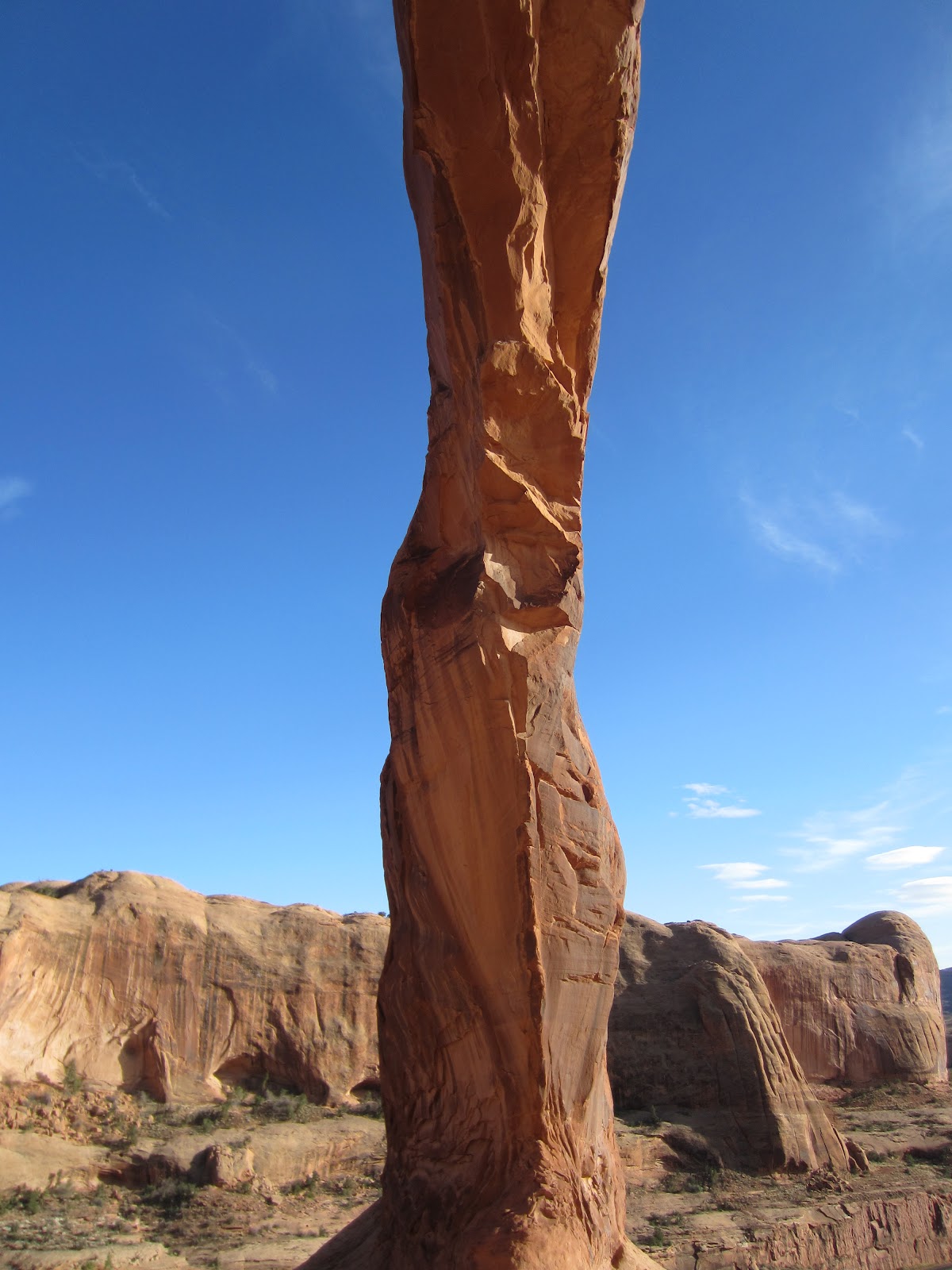


Aliens?


Petroglyphs


Dinosaur Tracks

Saturday, 03/31/12 Hunter Canyon/Pritchett Canyon Loop

In no hurry, we spent a good part of the morning taking advantage of the second B of B&B and chatting with the owner who made us a fine meal.  Finally around 9:30am, a few short miles of driving down Kane Creek Road from the B&B got us to the big lot where the road turns to dirt, where our plan was to walk/jog the few road miles to the mouth of Gatherer Canyon.  A short stint through Gatherer and a little route finding brought us to the trail that traverses high above Hunter Canyon, where we enjoyed some nice rolling singletrack/doubletrack with expansive views.

Routefinding with a map and GPS made things quite easy.  Could have done it without no problem I think, but it certainly added a nice level of comfort, as a small mistake could be very inconvenient at best.  Took a side trip over to Pritchett Natural Bridge (or Arch depending on the map) and searched high and low for the shortcut indicated on the Latitude 40 map that I have (geared toward mountain biking).  After a bit of poking around, we decided to give up and backtracked to where we originally left the Pritchett Canyon route.

It was an amazingly clear day and quite warm, 86 we would later find and it felt great to be out soaking it up.  We had plenty of food and water and had it not been for developing toe blisters and another damaged toenail (thanks again to La Sportiva shoes, the Electron this time), I felt like I could have just been out there indefinitely.  We took our sweet time descending Pritchett Canyon, as we discovered that we timed it just right with the Moab Easter Jeep Safari week and there were hordes of 4x4 enthusiasts testing their skills on the insanely technical road/trail (I am planning a separate post to cover that nuttiness).

We ended up getting in a touch over 15 miles for the loop with 2,000+ k of vert., in a little over 5 hours.

Starting up the dirt section of Kane Creek Road

Walking above Hunter Canyon

Hunter Canyon

Which way?  Where is that map?

Pritchett Arch


Funny side story from a "non-drinker"

Those who know me, often get a kick out of my teetotaler ways.  A few times per year, I will have a glass or of wine with dinner and once, maybe every 2-7 years, I will sip down a few margs, if the mood strikes me and if they happen to be free.

After cleaning up and relaxing at the B&B, we headed to the Moab Brewery for a well deserved dinner, where I was reminded of why I rarely, if ever drink.  

While ordering, we noticed they had some fun flavored, 18oz. margaritas on the menu and noticed them on nearby tables.  Feeling a bit carefree and celebratory of our hard earned and rare vacation time, I threw my general aversion to alcohol to the wind and ordered one up for Allison and I to split.  We started sipping and before I knew it, it was gone, leaving behind a 13oz pile of ice.  What?  Seriously?  $10.99 for a pile of ice?  I stewed and stewed, now focused on how I felt ripped off.  Stewed about how I would have been MUCH happier with a bottomless Coke or Lemonade for ~$2.  Hah, good for a laugh I guess, I'll never spend another cent on alcohol.

Sunday, 04/01/12 Moab Rim Trail/Hunter Canyon

Headed up the Moab Rim Trail from the river in the morning, following a long line of Jeeps that had just started up.  Climbing 900 feet in a bit under a mile, entirely on slickrock, this was my kind of trail and Allison gave me the nod to do my thing.  I took off up the trail, with the intent of competing with the Jeeps, further inspired by the insistence of one of the workers at the B&B that suggested it would take us 45 minutes to get to the rim overlook.  I was a little bogged from breakfast still, but my legs felt springy and I got into a good groove.  Passing the Jeeps was WAY easier than I thought, but even so, turned on the gas a bit as I passed just to show them up (most of the drivers/passengers were the sedentary type and looked/commented in awe as I floated past).  Also proved the B&B gal wrong in her 45 minute estimate, topping out in 13 minutes.  Turned around to meet Allison, who was surprisingly just a minute or so down the trail (though she had a few minute head start).

From the rim, we hiked/jogged intermittently toward the overlook on the far side of the mesa, totaling 9 miles for the RT.  Of course we took our time on the way back, spectating the Jeeping antics.

Great views of Moab


Extreme seems to be the name of the game in Moab.  Here, the unicyclists have at it.

Our turnaround point was up the dirt road in the center, behind the large sandstone wall


In the afternoon, we headed over to Hunter Canyon for a 3.5 mile RT walk.  Hunter Canyon is one of the few canyons with somewhat consistent water flow, tall trees and abundant vegetation.


Some rather large rocks have fallen, note Allison in the picture for scale
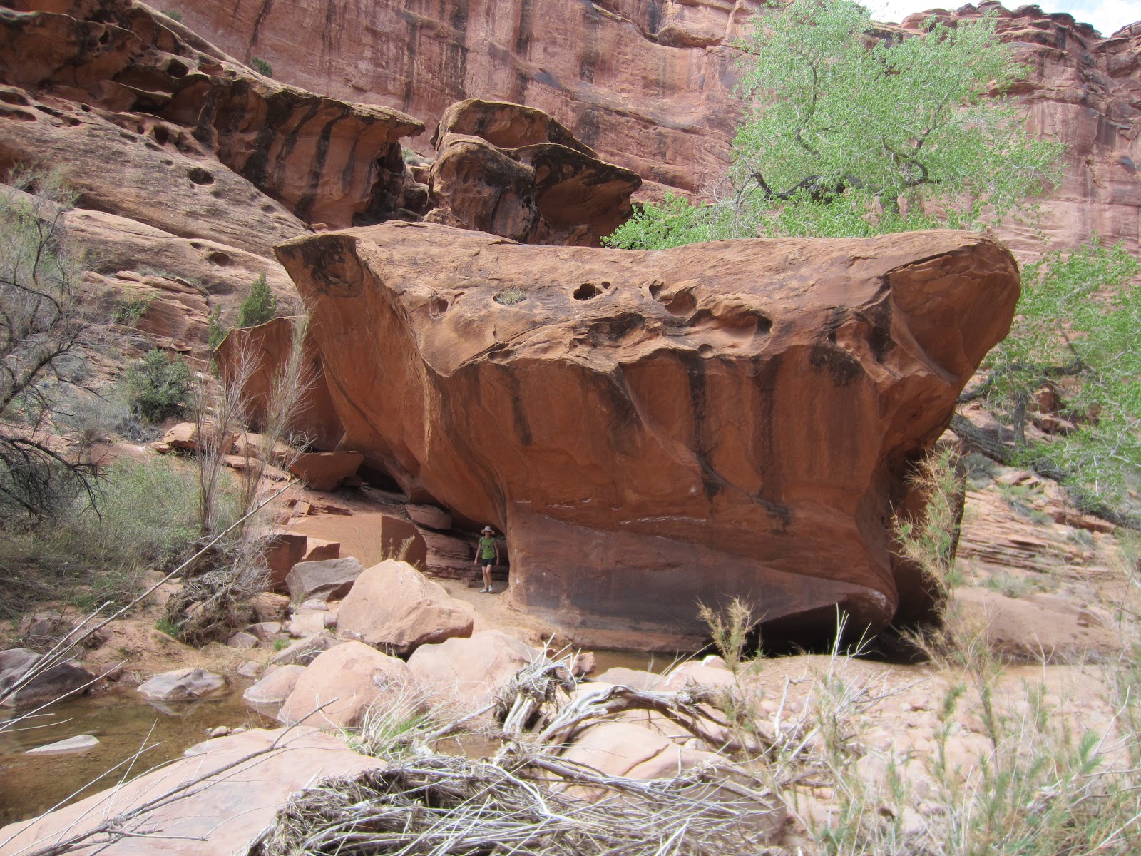
Cave of forgotten dreams....  This cave is MASSIVE and I tried to get up to it, but the going was a real scrubble scramble.  I made it 3/4 of the way up, but opted to not push my luck, as there was too much loose rock and hangfire.  I had to descend most of the upper part facing in and was a little sketched at times.  With a helmet and someone like Homie, I might have made it though.

Monday, 04/02/12 Hanging Lake, Finally.

So, the trick for Hanging Lake (which I subconsciously knew all along and is part of the reason we have never been until now) is that if you are approaching from the East (there is no exit Westbound for Hanging Lake) you have to get off at the Grizzly Gulch exit (121), then backtrack on I-70 4 miles to the Hanging Lake exit.  From the Hanging Lake exit (exit 125), you can not get back on I-70 Eastbound, so you have to backtrack West to exit 121 to turn around.  No matter which way you are travelling, a trip to Hanging Lake requires 8 additional miles in the car.  I have to say it is quite worth it though.

After a relaxing soak at Glenwood Hot Springs the previous night, we decided that we would figure out the Hanging Lake puzzle no matter what and finally check it out before we headed for home.  The trail is very well maintained to the lake and though the lake is smaller than I anticipated (more like a pond), we were quite impressed.  Seeing it in the off season was also quite a treat, as we shared the lake with two families for part of the time, yet otherwise had it to ourselves.  Quite an amazing spot.


Tuesday, March 27, 2012

Monday, 03/26/12 Bear Peak

Up Fern/Down Bear Canyon (from Cragmoor)

7.54 miles/3,028 vert./1:33 (45 up)/avg HR 147  Garmin Data

Was great to re-visit Fern after almost 2 months away on a nice warm day.  Legs were a little heavy and I was low on energy (have been flirting with being sick, again, for the past week, but now I think it is the real deal), though I had a great time being out on the trails.  Headed down W. Ridge and Bear Canyon which was enjoyable as always.  The wind was pretty gusty at times and I occasionally felt as though it was going to topple me over which required the occasional stop/drop, especially near the summit.

I am planning some days off from running, as I just feel like cumulative life stress, work stress, lack of sleep, being sick, injured ribs etc.... has all been conspiring against me a bit and I have felt less than ideal for about a week and a half.  Just need to hit the reset button so to speak.  Heading to Moab on Friday for a few days and have 10 days off of work total and really need it mentally.

Sunday, March 25, 2012

Saturday, 03/24/12 S. Boulder/Bear/Green and Green Again

Morning:

SoBo/Bear/Green from S. Mesa
(Towhee/Shadow/W. Ridge/GreenBear/New Trail/Bear Canyon/Mesa/Bluebell)

13 miles/4,602 vert./2:52/avg. HR 149  Garmin Data

Excellent morning run with GZ, Dave, Homie, Joe G, and Jason S..  Upper SoBo was a bit of a mess with deep snow and random Winter routing and made for some interesting moments on the way down, but otherwise the trails are mostly melted out.  Met up with the Timkos on Bear saddle and summit for a chat.

We went conversational pace most of the time, but despite not going tooo hard, I was often times uncomfortable breathing due to some bruised ribs and was unable to take deep breaths and each step hurt a bit.

Afternoon:

Green Mountain from Realization Point

3.37  miles/1,735 vert.  Garmin Data

Easy hike with the family up Ranger on a perfect afternoon.  SUPER crowded out there today, who can resist such weather?  Reluctantly carried the spikes for the very short snow section, but was very glad I did, especially for the descent (had to work around many people and rambunctious dogs).  Bumped into Kendrick and chatted with him for a bit.


Friday, March 23, 2012

Thursday, 03/22/12 Flatirons Vista - Friday, 03/23/12 Mayhoffer Loop

Thursday, 03/22/12 Marshall/Flatirons Vista Baby Jogger Run

5.39 miles/350 vert./48:11/8:56 pace/avg. HR 147  Garmin Data

Parked at 93/128 and headed N. on the trail toward Marshall.  Attempted to run both ways along the ditch, but it was too rocky/bouncy to do anything more than walk, so bailed on that.  Back up the hill to the lot, crossed 93 and headed West under the powerlines for a bit, but simultaneously got sick of that/ran out of time and headed back.  The views are great, but the variable trail surface (soft dirt/sand/rocks or embedded rocks) and numerous gates to negotiate did not make for a good run pushing toddlers.  Oh well, I will not head back there with the jogger, but it was a nice day and worth a shot.

Friday, 03/23/12 Mayhoffer SingleTree/66th Loop Baby Jogger Run

8.24 miles/480 vert./1:08:23/8:18 pace/avg. HR 144  Garmin Data

Parked at the trailhead in Superior and ran the Mayhoffer SingleTree trail over to 66th, headed S., took a short diversion toward Marshall Lake, but as expected, was gated off.  I debated going through, but I was wearing a hunters orange hat, red shirt and there were plenty of threatening signs, so I decided it was a bad idea (as inviting as it looked though to explore).  After the girls had a snack, we then headed down the Koppenburg to W. Coal Creek and back to the trailhead.  Did a quick up/back on the Alpe d Superior, where I bumped into Shad who was out there doing hill intervals (looked painful).  Overall a pretty mellow run on a perfect day.

Love this stretch of trail, running and on a bike

Keep out!!!

Snack time.

Looking down the 17% grade Koppenburg (in very good condition, hopefully it degrades for the race on April 28th to make it interesting)

Looking back up (this is what I rode down/up/down while towing the girls on my bike last weekend)

No better time for a snooze

Flatirons

Bear Peak/Slab

 4th/3rd/2nd/1st Flatirons with Audubon/Notabon in the background

Tuesday, March 20, 2012

Tuesday, 03/20/12 Green Mountain

Up/Down Back

5.29 miles/2,294 vert./1:09:32 (42:02 up)/avg. HR 138  Garmin Data

Pretty easy run up and down.  Walked the snow/ice section from below the last switchback to the 4-way (and gingerly tip toed it on the down), otherwise the entire trail is mostly dry.  Got spoiled by the warm weather last week and it felt awkward wearing pants and long sleeve shirt again.

Monday, March 19, 2012

Sunday, 03/18/12 The Remainder Of The Week

Wednesday, 03/14/12 Green Mountain (up/down NE ish)

3.12 miles/2,285 vert./55:57(34:36 up)/avg. HR 156  Garmin Data

OK effort on the up, but lost some time slipping and sliding in the soft snow on upper Greenman without spikes, which would have helped, but were hardly worth carrying.  Very easy down the snow, then a little quicker once on the mostly dry NE Ridge.

Thursday, 03/15/12 Local Baby Jogger Run

10 miles/296 vert./1:17:50/7:47 pace/avg HR 147 

Mellow to moderate run to Runners Roost, to Lowes to pick up a few things, then up the steep and loose (feels steep when pushing a double jogger) connector to Davidson Mesa, petted horses and then did an extra outer lap before heading home.

Friday, 03/16/12 Local Baby Jogger Run

5.05 miles/119 vert./40:34/8:02 pace/avg. HR 135

Tour de Playgrounds.  Wanted to go longer, but between Gymboree Class, naps and other things going on, I was lucky to sneak in 5 miles to various playgrounds, which was fine because once I got running, I did not feel like doing much more.

Saturday, 03/17/12  Mountain Bike Ride

~18 miles/1,300 vert.

Loaded the girls into the bike mode Chariot for an adventure ride that included a dark and muddy tunnel under 36, a cemetary, overgrown grassy double track, working our way through a barbed wire fence, cruising nice wide dirt singletrack on the Mayhoffer/Singletree Trail and going down, up, down the Koppenburg hill (~17% where S. 66th meets Coal Creek Dr.).  Then of course more playgrounds.  Super warm day, maybe mid to upper 70s?

Sunday, 03/18/12  Green Mountain

Up A/S/G, Down Bear Canyon

8.19 miles/2,707 vert./1:31:20 (38:21 up)/avg. HR 143  Garmin Data

Fairly mellow run, taking it somewhat easy to not jostle too much, as I stupidly banged up my ribs on a steep and curvy playground slide the previous day.  Even though I have trouble getting in/out of bed, I was surprisingly OK while running rough trails.  Go figure.  It was super windy when I left work and the sky was brown with dust and dirt, but once at the Gregory lot, things had calmed a bit and I even enjoyed a bit of sunshine on the summit and while running down Bear Canyon.  Driving home it looked like the sky was falling, super dark brown sky, like a giant dirt tornado bearing down on the foothills.


OK, the $hit "___" says videos are a little over played, but I thought these were pretty funny (if you are a cyclist).


Tuesday, March 13, 2012

Tuesday, 03/13/12 Local Baby Jogger Run

4.63 miles/165 vert./42:54/9:16 pace/avg. HR 118

Very easy run from home with the Allison and the girls.  Very warm, a little windy.

Monday, March 12, 2012

Monday, 03/12/12 Green Mountain

Up Front/Down NE

3.77 miles/2,284 vert./1:01:11 (38:12 up)/avg HR 145  Garmin Data

I was feeling lazy, but could not resist getting outside on a 70+ degree day.  Was very sluggish and uncoordinated, mainly a result of 2 consecutive very short nights of restless sleep (a result of the time change, coupled with having to work very early and a few other life stress things going on).  The upper half of the mountain was pretty slick and punchy, even with spikes.  Carefully descended the NE Ridge, but felt like I had two left feet, so I went super easy and careful, as conditions were a mixed bag much of the way.  Even though tired, it was quite rejuvenating to get outside.